Saturday-Sunday storm to bring every kind of wintertime yuck
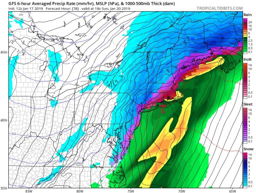
Saturday evening and most of the day Sunday the Tri-State Area will be on the receiving end of a storm that appears to bring every type of wintertime yuck that exists: thunderstorms, soaking rains, sleet, freezing rain, ice storms and a real thump of snow if you are north and west of the city, especially at elevation. At certain points Saturday, on the front end of this system, it could snow one to three inches an hour. (So, high snow ratios, as the pros would say.)
This particular frame from the GFS model (above) shows rain for New York City and Long Island, freezing rain and sleet for Westchester and the Bronx, an ice storm for Connecticut and snow for all the folks under the blue tinting. This storm is super-tricky to guess at totals, but suffice to say, it will be a mess, if not a Nor’easter-style snow bomb. And our old nemesis, the Polar Vortex, will be paying a visit almost immediately after this system moves out. Brrr! A good weekend for Netflix, presuming the power doesn’t go out.
Brendan Hasenstab is special meteorology consultant to the Pelham Examiner.


