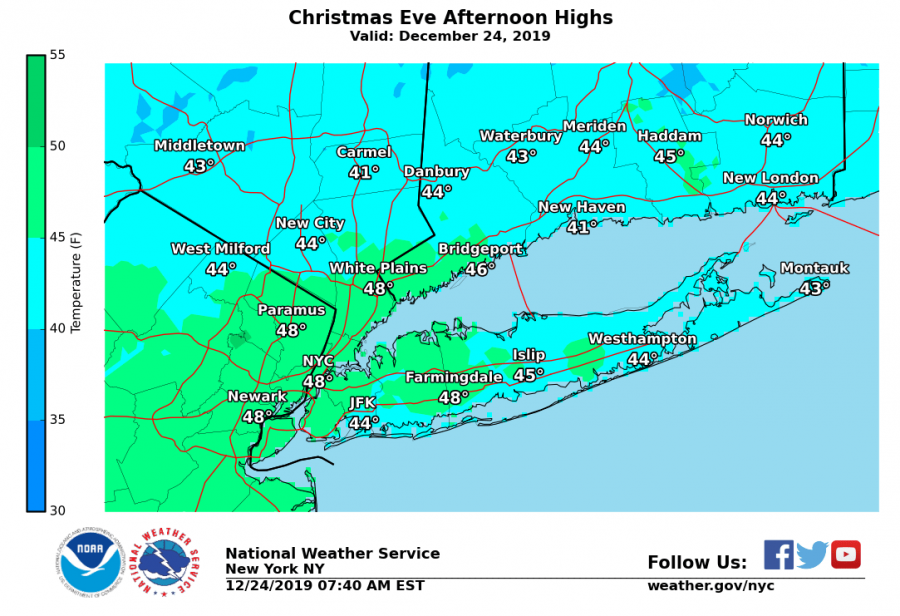


National Weather Service: Radar clear, forecast for cool, dry Christmas Day in low 40s
Editor’s note: This forecast was provided by the National Weather Service.
SHORT TERM /6 PM THIS EVENING THROUGH THURSDAY/…
High continues to meander southeast as winds diminish overnight. With post frontal dew points in the low 20s, ambient temperatures fall into low 30s near the city with a rapidly decreasing temperature gradient into the low 20 along the Lower Hudson Valley and southern CT. The high shifts off the coast of Cape Cod Christmas Day permitting winds locally to shift lightly out of the south. Conditions will remain cool and dry for the day with widespread temperatures in the low 40s for the forecast area.
Wednesday evening the synoptic pattern becomes more active. Ridge axis over the Great Lakes region amplifies and move eastward. As this occurs a high over interior Quebec builds south into New England with the leading edge of this high effectively acting as a backdoor cold front. Winds pivot out of the north overnight Wednesday into Thursday and temperatures drop back into the low 30s and upper 20s. Increased cloud cover associated with this front crosses south into the Lower Hudson valley Thursday afternoon. The additional clouds will help keep temperatures chilly and in the low 40s during the daylight hours.