

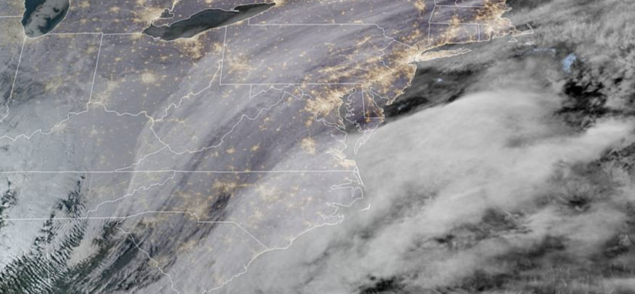
Nor’easter: Latest from National Weather Service on 24-hour storm, possible near-blizzard conditions
URGENT – WINTER WEATHER MESSAGE
National Weather Service New York NY
331 PM EST Fri Jan 28 2022
Northern Fairfield-Southern Fairfield-Hudson-Southern Westchester-New York (Manhattan)-Bronx-Richmond (Staten Island)-Kings (Brooklyn)-Northern Queens-Southern Queens.
WINTER STORM WARNING REMAINS IN EFFECT FROM 7 PM THIS EVENING TO 7 PM EST SATURDAY…
* WHAT…Heavy snow expected. Total snow accumulations of 7 to 10 inches. Winds gusting as high as 45 mph. Near blizzard conditions are possible for a period on Saturday.
* WHERE…Portions of northeast New Jersey, southern Connecticut and southeast New York.
* WHEN…From 7 PM this evening to 7 PM EST Saturday.
* IMPACTS…Travel could be very difficult. The hazardous conditions could impact the evening commute. Gusty winds could bring down tree branches.
* ADDITIONAL DETAILS…Visibilities may be reduced to 1/4 mile or less at times Saturday morning.
PRECAUTIONARY/PREPAREDNESS ACTIONS…
If you must travel, keep an extra flashlight, food, and water in your vehicle in case of an emergency.
Check local Department of Transportation information services for the latest road conditions.
Click to review the NWS Powerpoint slides on the “strong winter storm.”